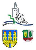
Overview of the Most Important Facts And Figures:
| Administrative District: |
Ore Mountains (Erzgebirgskreis) |
| Inhabitants: |
about 10.500 |
| Area: |
22,90 km² |
| Population Density: |
442 inhabitants / km² |
| Registration Plate: |
ERZ / ZP (previously MAB) |
| Postcode: |
09405, 09434, 09401 |
| Dialing Code: |
++49 (0)3725 |
| Town Structure: |
Zschopau with the districts Krumhermersdorf (since 1999), Ganshäuser and Wilischthal |
| Neighbouring Municipalities & Towns: |
Gornau/Erzgebirge 4 km |
| Religious Affiliation: |
Lutheran: 2181 |
| Federal State: | Free State of Saxony |
Development of Number of Inhabitants:
| year | total | male | female |
| 1990 | 12.799 | 6.129 | 6.670 |
| 1991 | 12.527 | 5.969 | 6.558 |
| 1992 | 12.284 | 5.881 | 6.403 |
| 1993 | 12.150 | n/a | n/a |
| 1994 | 11.903 | n/a | n/a |
| 1995 | 11.720 | 5.596 | 6.124 |
| 1996 | 11.457 | 5.476 | 5.981 |
| 1997 | 11.252 | 5.383 | 5.869 |
| 1998 | 11.065 | 5.289 | 5.776 |
| 1999 | 12.563 | 6.036 | 6.527 |
| 2000 | 12.364 | 5.950 | 6.414 |
| 2001 | 12.307 | 5.925 | 6.382 |
| 2002 | 11.930 | 5.753 | 6.177 |
| 2003 | 11.829 | 5.740 | 6.089 |
| 2004 | 11.674 | 5.655 | 6.019 |
| 2005 | 11.518 | 5.584 | 5.934 |
| 2006 | 11.266 | 5.488 | 5.778 |
| 2007 | 10.930 | 5.295 | 5.635 |
| 2008 | 10.681 | 5.176 | 5.505 |
| 2009 | 10.474 | 5.117 | 5.357 |
| 2010 | 10.317 | 5.029 | 5.288 |
| 2011 | 10.115 | 4.944 | 5.171 |
Geographical Location:
| Latitude: |
50.747053 (50° 44‘ 49,39‘‘ north) |
| Longtitude: |
13.069106 (13° 4‘ 8,78‘‘ east) |
| lowest ask: |
300 m above sea level |
| Highest Elevation: |
600 m above sea level |
